Everything You Need To Know About Roads & Public Transport In Portland

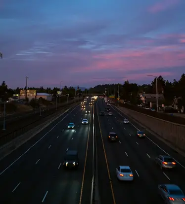
Portland, Oregon, features a robust and extensive network of highways and major roads that not only facilitate intra-city travel but also establish vital connections with other states and destinations.
Major Routes & Highways
One of the primary arteries of the city, Interstate 5 (I-5), flows in a north-south direction, stitching Portland to other major cities like Seattle to the north and Sacramento to the south. This interstate is pivotal for both local commutes within the Portland metropolitan area and long-distance travel, including providing a key route to Portland International Airport and a vital connection over the Columbia River into Washington State via the Interstate Bridge.
Parallel to I-5 on the city’s eastern flank is Interstate 205 (I-205), which also runs in a north-south direction, providing another valuable conduit to the airport and acting as an alternative route to alleviate traffic on I-5 during peak hours. Meanwhile, another essential interstate, I-84, also referred to as the Banfield Freeway, stretches in an east-west direction. I-84 begins in Portland and extends all the way to the Idaho state border, offering a significant route for those venturing towards the eastern expanses of Oregon or farther into eastern states.

Within the city itself, Interstate 405 (I-405) forms a semi-loop around downtown Portland, providing a bypass that allows motorists to navigate around the central city area and reconnect with I-5 on both ends. This facilitates smoother intra-city transit and alleviates congestion in the core downtown area.
Complementing the interstates, U.S. Route 26 (US-26) is another key highway facilitating east-west travel. This highway stretches from the city to the picturesque locales of the Oregon Coast in the west and extends towards Idaho in the east, serving as a vital route for leisure, commerce, and everyday travel.
Integral Portland Roads
Beyond highways, Portland’s grid of major roads plays an integral role in daily commutes and exploration of the city. Burnside Street, slicing the city into north and south halves, is a crucial east-west thoroughfare that spans from the eastern suburbs through downtown and into the western regions of the city. Similarly, Division Street, another crucial east-west road, courses through numerous neighborhoods, presenting an eclectic array of dining and shopping options along the way.
Sandy Boulevard offers a unique pathway through the city, with its diagonal orientation slicing through the grid and providing a direct route from the northeast neighborhoods to the central city. Additionally, Martin Luther King Jr. Boulevard, often referred to simply as MLK, runs in a north-south direction, parallel to the Willamette River, serving as a major avenue in the eastern sectors of the city.
Portland Bridges
Portland, often referred to as “Bridge City,” is known for its numerous bridges that not only define the city’s skyline but also serve as crucial connective infrastructures across the Willamette River, uniting the east and west parts of the city. Each bridge carries various types of transportation, including vehicular roads, pedestrian walkways, bicycle lanes, and even rail lines, ensuring a multimodal approach to connectivity in the city.
The Burnside Bridge, which carries Burnside Street across the river, acts as a central demarcation line for the city’s northern and southern sectors. It’s notable for connecting downtown to the east side and being a pivotal route for public transit, pedestrians, and cyclists.
Hawthorne Bridge, one of the city’s oldest and most iconic spans, conveys traffic along Hawthorne Boulevard, creating a vital link that accommodates vehicles, bicyclists, and pedestrians while also featuring a distinctive truss and lift-span design.
The striking St. Johns Bridge, with its gothic architecture and soaring towers, connects the St. Johns neighborhood to areas west of the river and towards Scappoose and provides a direct link to U.S. Route 30. Not only crucial for vehicular traffic, but this bridge is also favored for its scenic vistas by pedestrians and cyclists.

Tilikum Crossing, also known as the “Bridge of the People,” is the newest addition to Portland’s bridge-scape and is distinct for being reserved exclusively for public transit, cyclists, and pedestrians, omitting private vehicular traffic. The bridge connects the South Waterfront and Central Eastside districts and carries the MAX Orange Line, buses, and the Portland Streetcar.
Ross Island Bridge, which ushers U.S. Route 26 across the water, provides a vital link from the southeast part of the city to the southwest, bypassing the downtown area. This bridge is notably less pedestrian-friendly due to its limited walkways and high traffic volumes.
The Morrison Bridge, sitting north of the Hawthorne Bridge, assists in connecting the downtown and inner eastside regions of Portland and is particularly notable for its lift span that allows larger vessels to navigate through.
Moving further north, the Steel Bridge serves as a multimodal conduit with lower and upper decks that cater to vehicular, pedestrian, and bicycle traffic, while also playing a crucial role in the city’s public transit network by accommodating MAX Light Rail and Amtrak lines.
Further to these, the Broadway Bridge, Fremont Bridge (which carries I-405), and Marquam Bridge (a vital part of I-5) among others, each contribute to Portland’s infrastructural network and urban connectivity in their unique ways.

One Reply to “Everything You Need To Know About Roads & Public Transport In Portland”