Everything You Need To Know About The MAX In Portland
The MAX, or Metropolitan Area Express, is a light rail system that has become a staple of the Portland metropolitan area in Oregon. Its inception in the 1980s marked a significant step for the region in modernizing its public transportation infrastructure.
MAX History
The first MAX line, known as the Blue Line, began its construction in the early 1980s. By 1986, it was operational, connecting downtown Portland to Gresham. This initial line laid the foundation for what would become a comprehensive rail transit system for the city and its surrounding areas.
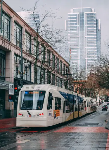
Throughout the 1990s, the vision for the MAX system expanded. The region recognized the benefits of the Blue Line and sought to extend its reach. This decade saw the introduction of the Westside extension, which took the Blue Line all the way to Hillsboro by the late 1990s. Around the same time, the Red Line was introduced, providing a direct link between downtown Portland and the Portland International Airport.
The early 2000s continued the trend of expansion. The Yellow Line was introduced, connecting North Portland to the city center. This was followed by the Green Line in the late 2000s, which linked Clackamas to downtown Portland, passing through the Oregon Convention Center and Portland State University.
The Orange Line was the latest addition, opened in 2015. It connected downtown Portland to Milwaukie, passing over the Tilikum Crossing, a bridge that’s unique for being dedicated to transit, cyclists, and pedestrians, without any lanes for private cars.
The overall cost for the construction of the MAX system has spanned several decades, and the cost varied for each line and extension. Funding for the system came from a combination of local, state, and federal sources. For instance, the original Blue Line cost over $200 million, while the more recent Orange Line had a price tag of about $1.5 billion. These costs encompassed everything from infrastructure to train cars, stations, and other necessary facilities.
Today, the MAX system spans over 60 miles and has multiple lines serving various parts of the Portland metropolitan area.

List Of Terminal Stations For The MAX
- Blue Line:
- West: Hillsboro Central/SE 3rd Ave Transit Center in Hillsboro
- East: Cleveland Ave Station in Gresham
- Red Line:
- West: Beaverton Transit Center in Beaverton
- East: Portland International Airport
- Green Line:
- North: Expo Center in North Portland
- South: Clackamas Town Center Transit Center in Clackamas
- Yellow Line:
- North: Expo Center in North Portland
- South: PSU South/SW 5th and Jackson in Downtown Portland
- Orange Line:
- North: Union Station/NW 6th & Hoyt in Downtown Portland
- South: Park Avenue in Milwaukie
How Much Does Using The Portland MAX Cost?
The price for using the Portland MAX is very reasonable and becomes cheaper the more it is used. Riding for 2.5 hours currently costs $2.80 with a day pass costing $5.60 After spending $5.60 in a single day, the price is capped and riders will not be charged anymore.
A monthly pass costs $100 and works in the same way, once charged, it will not cost you any more money.
Youths, people with disabilities, and seniors get a heavily discounted rate of $2.80 for a day pass and only $28 for a monthly pass.

Details About Each Line On The MAX
Blue Line (Hillsboro to Gresham)
Route: The Blue Line connects the western suburb of Hillsboro to the eastern suburb of Gresham, passing through downtown Portland.
Key Stops: Hillsboro Central, Beaverton Transit Center, Sunset Transit Center, Providence Park, Pioneer Courthouse Square, Gateway/NE 99th Ave Transit Center, and Gresham City Hall.
Length: Approximately 33 miles.
Operational Notes: It was the first line of the MAX system, opening in 1986.
Red Line (Beaverton to Portland International Airport)
Route: The Red Line links Beaverton in the west to Portland International Airport in the northeast.
Key Stops: Beaverton Transit Center, Sunset Transit Center, Providence Park, Pioneer Courthouse Square, Gateway/NE 99th Ave Transit Center, and the airport.
Length: Roughly 26 miles.
Operational Notes: Introduced in 2001, it was the first direct rail service between downtown and the airport.
Green Line (Downtown Portland to Clackamas)
Route: The Green Line runs from downtown Portland to Clackamas in the southeast.
Key Stops: PSU, Pioneer Courthouse Square, Gateway/NE 99th Ave Transit Center, and Clackamas Town Center Transit Center.
Length: About 15 miles.
Operational Notes: Opened in 2009, it was designed to improve access to the southeastern suburbs.
Yellow Line (Downtown Portland to Expo Center)
Route: The Yellow Line connects downtown Portland to the Expo Center in the north.
Key Stops: PSU, Pioneer Courthouse Square, Interstate/Rose Quarter, and Expo Center.
Length: Approximately 10 miles.
Operational Notes: Launched in 2004, it was part of a plan to revitalize the North Interstate Avenue corridor.
Orange Line (Downtown Portland to Milwaukie)
Route: The Orange Line runs from downtown Portland to the suburb of Milwaukie in the southeast.
Key Stops: PSU, Tilikum Crossing, and Milwaukie/Main St.
Length: About 7.3 miles.
Operational Notes: Opened in 2015, the Orange Line features the Tilikum Crossing, a bridge that’s unique for being dedicated to transit, cyclists, and pedestrians, without any lanes for private cars.

One Reply to “Everything You Need To Know About The MAX In Portland”